Can You Use GPS Without Internet?
Yes. Your phone's GPS receiver listens to satellites; it does not need a SIM, a data plan or a Wi-Fi network to work out where you are. What stops working without a connection is everything around the position: the map underneath it, live search, and anything that gets calculated on a server. Prepare those before you leave and the phone navigates fine with no signal at all.
GPS and internet are not the same thing
GPS is one-way. The satellites broadcast, your phone listens, and it works out latitude, longitude, speed and heading on its own. No coverage is needed for any of that — this is why an aircraft's moving map still knows where it is.
The confusion comes from map apps. Most of them stream their map from the internet as you move. Lose the connection and your position is still perfectly known — it is just floating on a blank grey background, which feels like the GPS broke. It didn't. The map is the part you have to download in advance.
What works with no signal, and what stops
Still works: your position and heading, a map you downloaded beforehand, a GPX Track already on the phone, off-track and wrong-way warnings, and recording your ride.
Stops until you have a connection: downloading new map areas, searching for places, satellite imagery (it streams and cannot be stored), and calculating a new route — that computation runs on a server, so generate the route while you still have coverage and follow it offline afterwards.
Before you leave: the five-minute checklist
1. The Track is on the phone — imported into the app, not sitting in an email.
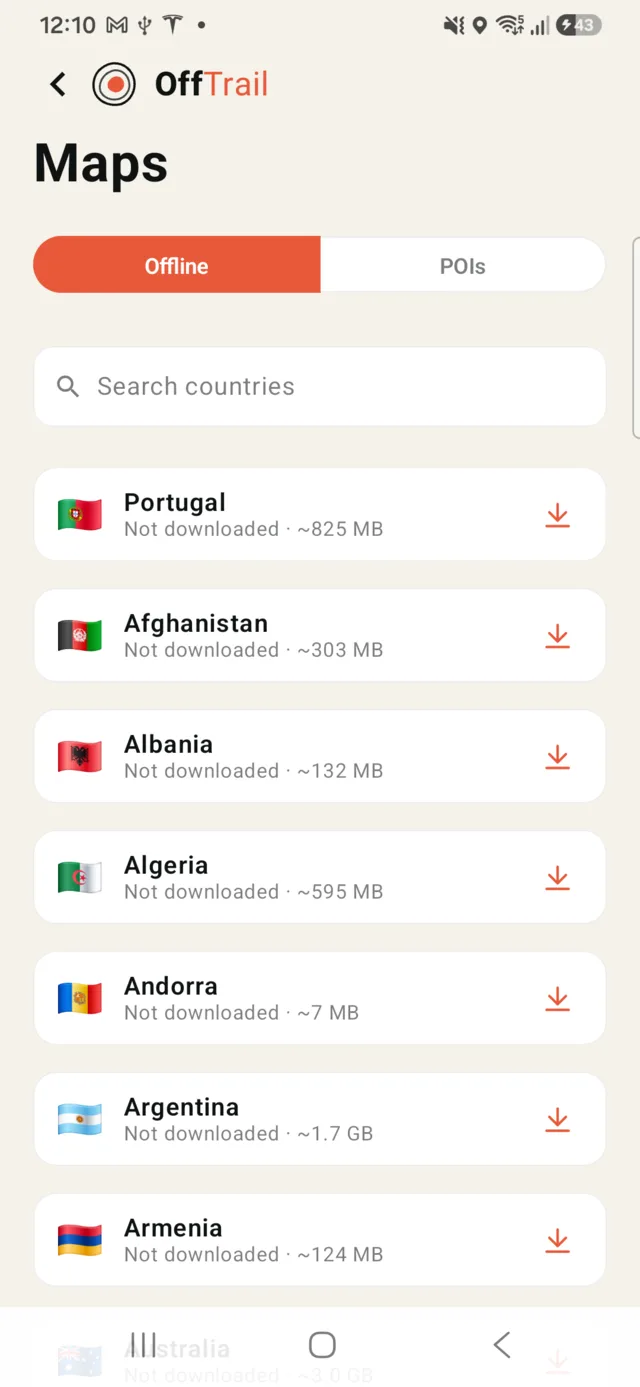
2. The map is downloaded for the whole area, not just the start — in OffTrail, a country at a time, or a region at a time in the biggest ones (US states, French régions, German Länder). Check the route doesn't cross into a region you haven't downloaded.
3. Location permission is granted, and on iPhone Precise Location is on for the app. Approximate location is useless on a trail.
4. Any generated route is already made — routes are computed on a server, so create them before the signal goes.
5. Power. A GPS fix plus a lit screen eats battery; bring a way to charge.
Then put the phone in airplane mode if you want — the navigation carries on. Airplane mode normally leaves GPS running, but a few devices switch location off with it, so test it in the driveway rather than at the trailhead.
When something is wrong: what it usually is
You see your position but the map is blank. The map for that area was never downloaded, or you are on a layer that only streams. Satellite imagery is online-only by design; switch back to the vector map.
No position at all. Location permission is off for the app, or location is off system-wide. Check the app's permission before blaming the signal.
The first fix takes minutes. That is a cold start. Without a connection the phone can't get the assistance data that normally speeds it up, so give it a clear view of the sky and stand still for a minute — under a metal roof or between buildings it can take much longer.
The position jumps around. Deep valleys, dense forest, tunnels and canyon walls bounce or block satellite signals. It settles again in the open.
You can't create a new route. Expected — route generation needs a connection. Follow the Track you brought, or ride back into coverage.
Doing it in OffTrail
OffTrail downloads offline maps for more than 100 countries — one package per country, split into regions for the largest ones — and they cost nothing. Import your GPX, download the country, and the map, your position, the Track, the off-track and wrong-way warnings and the ride recording all keep working in airplane mode — on the phone and on the car screen.
What exactly stays available is broken down on offline GPX navigation. Getting the Track in is platform-specific: on iPhone and on Android. If you want the route created for you before you go, the Route Planner builds it on the web and hands it to the app.
OffTrail is free on the App Store and Google Play. No account.
Frequently asked questions
Can I use GPS without an internet connection?
Yes. GPS positioning comes from satellites and needs no mobile data. What needs a connection is downloading maps, searching, streaming satellite imagery and calculating a new route.
Does GPS work in airplane mode?
Usually yes, as long as Location Services stays enabled. A few devices turn location off together with the radios, so test it before you rely on it.
Why does my position show but the map is grey?
The map for that area was never downloaded, or you are on a layer that only streams — satellite imagery cannot be stored offline. The position is fine; the map is what is missing.
Why is the first GPS fix so slow offline?
Cold start. Without a connection the phone cannot fetch the assistance data that normally speeds up the first fix, so it reads it from the satellites. Clear sky and a minute standing still.
Can OffTrail calculate a new route offline?
No. Route generation runs on a server and needs a connection. Generate the route before you lose coverage, then follow it offline.
Do offline maps cost anything?
No. OffTrail is free, offline maps for more than 100 countries included.